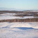
Mountain Landscapes - Bonaparte Plateau
|
|
Data PortalData type: Camera Data Number of Cameras: 50 Area: 6,800 km2 Timespan: 2012-2023 (not continuous) Camera data and models: Email us to discuss data sharing Landcover data: BC Data Catalogue Metadata: See Publications, below. |
The Bonaparte Plateau study area is part of the Government of BC’s Moose Research Project which examines causes for moose population declines. The study area was selected due to its high level of MPB infestation and resource extraction.
Cameras deployed within the study area will be used in conjunction with the Government of BC’s radio-collared 8-month old calf moose data to understand the impacts of human landscape disturbance (primarily logging) on large carnivore distributions and moose habitat selection, survival and predation risk.
For more information on previous studies conduction in this region, see the 'Associated Publication' below.

|
Associated Publications:
Francis, A, J.T. Fisher, C. Procter, and G. Kuzyk. 2021. Female moose prioritize forage over mortality risk in harvested landscapes. Journal of Wildlife Management 85(1): 156-168. https://wildlife.onlinelibrary.wiley.com/doi/abs/10.1002/jwmg.21963 |
|