Boreal Landscapes - Whitefish LAKE First nation
Traditional territory
|
|
Data PortalData type: Camera Data Number of Cameras: 100 Area: 6000 km2 Timespan: 2018-2021 Camera data and models: Data are owned by Whitefish Lake First Nation. For information, contact [email protected]. Landcover data: ABMI's Human Footprint Database. Publications: Jason T Fisher, Fabian Grey, Nelson Anderson, Josiah Sawan, Nicholas Anderson, Shauna-Lee Chai, Luke Nolan, Andrew Underwood, Julia Amerongen Maddison, Hugh W. Fuller, and Sandra Frey. Indigenous-led camera-trap research on traditional territories informs conservation decisions for resource extraction. FACETS 6: 1266-1284. Media: UVIC News |
|
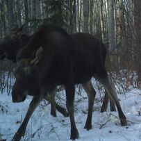
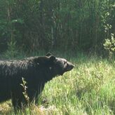
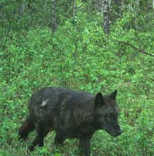
Whitefish Lake First Nation is a Treaty 8 Nation in northern Alberta. Whitefish Lake First Nation peoples have noticed significant changes to wildlife communities on their Traditional Territories.
Elders' knowledge holds that the changes to the Territory by resource extraction changed how prey, then predators were using the territory, leading to population changes. However decision-makers and industry often demand western science as proof. WLFN partnered with us to investigate these changes through lens of remote cameras. We wove together Indigenous Knowledge and western science to discover the root causes of wildlife change. WLFN are the first Nation in the oil sands to publish research on the marked changes in the land and animal they rely upon. Contact Whitefish Lake First Nation for more information. |

|